Gauenstein route

Easy
Einkehrmöglichkeit
Familienfreundlich
Rundtour
Hiking · Refreshment stops · Round trip · Family-friendly
01:35 h duration
5,57 km Länge
755 m Höchster Punkt
648 m Tiefster Punkt
108 hm Aufstieg
113 hm Abstieg
Kondition
Schwierigkeit
Erlebnis
Landschaft

Tourbeschreibung

Kirchplatz Schruns - pedestrian zone - Broxweg - Gauenstein Monastery - Landschrofen-Känzili viewpoint - JUFA Montafon - Kaltenbrunnen train station - Ill cycle path - Tschagguns train station - Litz promenade - Kirchplatz Schruns

If Broxweg is closed due to logging work or other reasons, we recommend walking from the Litz chapel along Außerlitzstraße to the Vitalhotel Gauenstein and from there to Gauenstein Monastery.

Description

This cozy round is well suited for a long walk. There are dining options along the route (Schruns town center, JUFA Montafon, and the branch of Schapler bakery as well as Liberty snack bar in Gantschier/Kaltenbrunnen). The walking route is ideal for children. At the Landschrofen-Känzili viewpoint, children can linger, play in the forest, or be creative. The JUFA Montafon (large indoor playground) is only a few meters from the route. And if you no longer want to walk in Gantschier (Kaltenbrunnen), you can take the bus or train back to Schruns.

The route offers great views: From Montjola (Broxweg), you can see Schruns-Tschagguns from above and have the Zimba mountain peak in sight. From Gauenstein Monastery, you enjoy a wonderful view of the Montafon landmark, the famous Three Towers in the Rätikon. Depending on visibility and weather, the Three Towers seem within reach (especially in föhn weather).

Approach

Drive on the A14 to the Bludenz/Montafon exit and continue on Montafonerstraße L188 to Schruns.

Public transport

Just leave your car parked

Regional buses operate throughout Montafon. The main lines run every half hour from Schruns train station.

Bus stop at the start/finish of the route: Schruns train station / s4 (Montafonerbahn), line 601, line 602, line 603, line 640, line 650, line 670, line 680

Schedule: www.vmobil.at

Arrival by train to Montafon

From Bludenz train station, the Montafonerbahn runs hourly (sometimes every half hour). There are also direct connections from Lindau (D) and from Bregenz.

Schedule: www.oebb.at

Parking

Parking is available in the center of Schruns (paid).

Directions

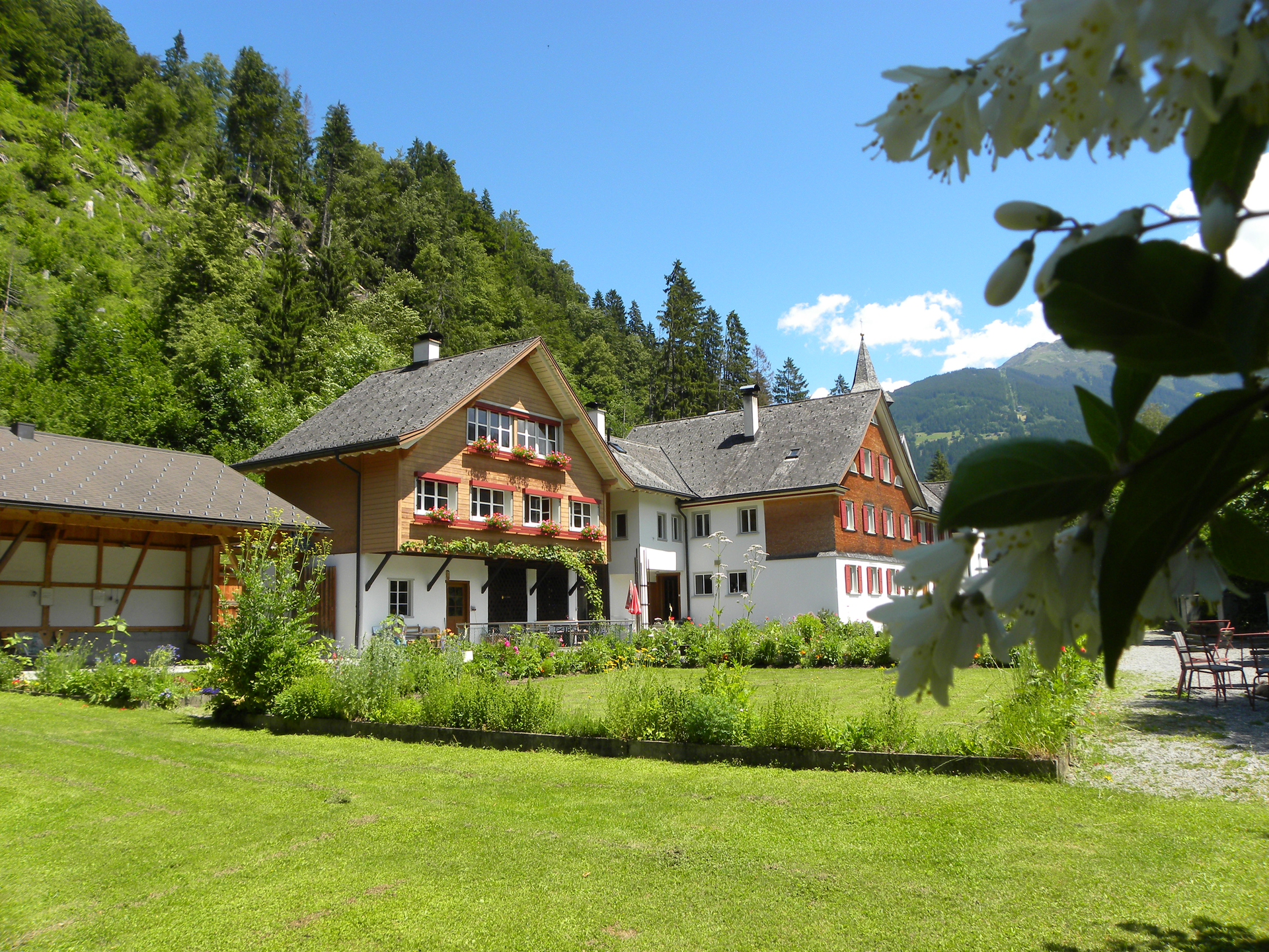
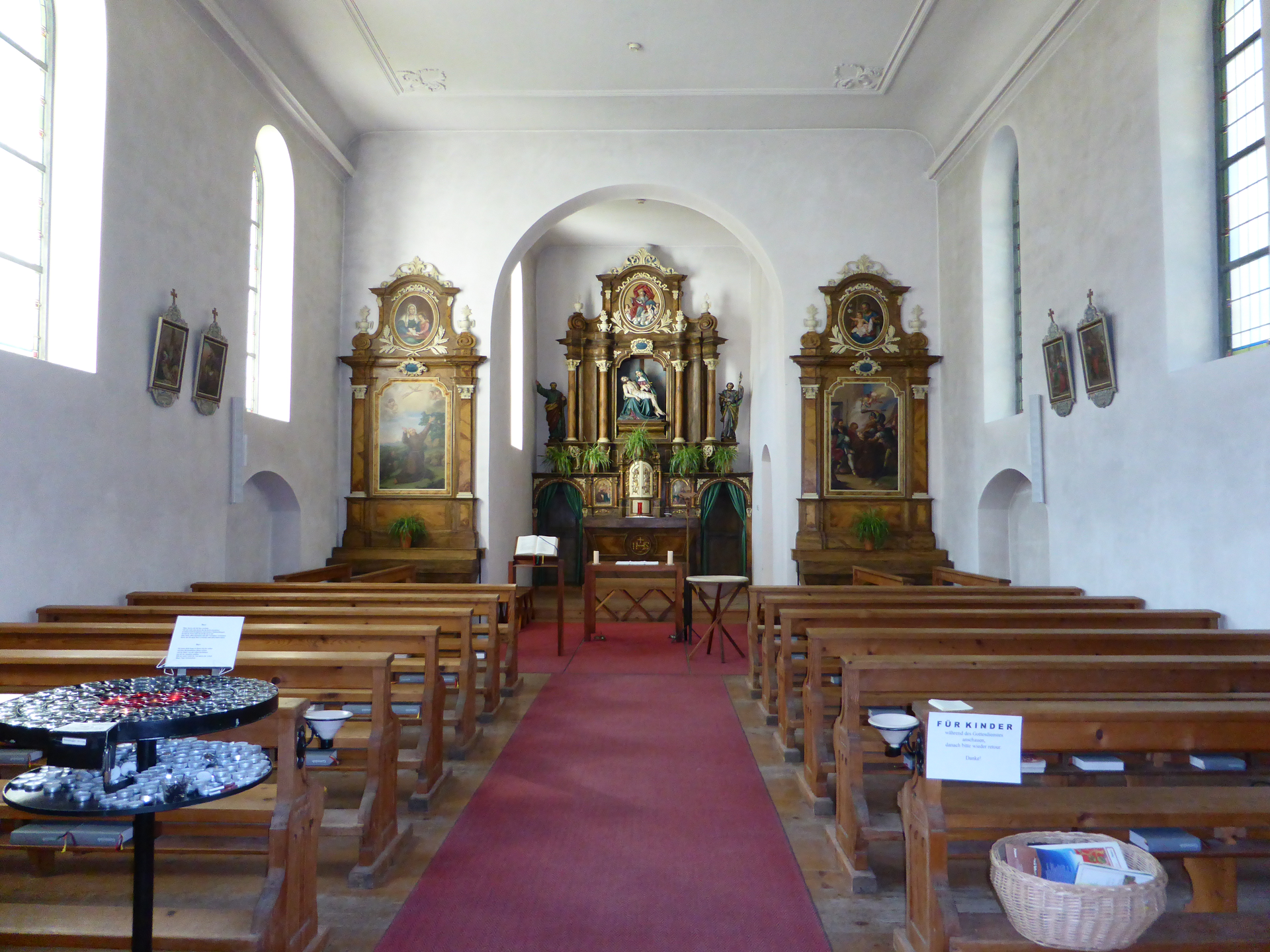
The Gauenstein route starts in the town center of Schruns. At the parish church St. Jodok, the pedestrian zone slopes slightly downward until you reach Silbertalerstraße. There, you cross the street and walk left past the store Zimba Moden and shortly afterwards cross the bridge and continue straight ahead. You walk past Hotel Krone and a few meters later reach a small chapel (Litz chapel) and the junction leading up to Bartholomäberg. You follow Montjolastraße to the first curve, where you turn left and follow the driveway. After a short forest section, you reach a single house with a great location via a meadow path that slopes slightly upward. Then the path goes briefly downhill and you pass more houses. The forest road then continues flat and after about 5-10 minutes you reach Gauenstein Monastery.

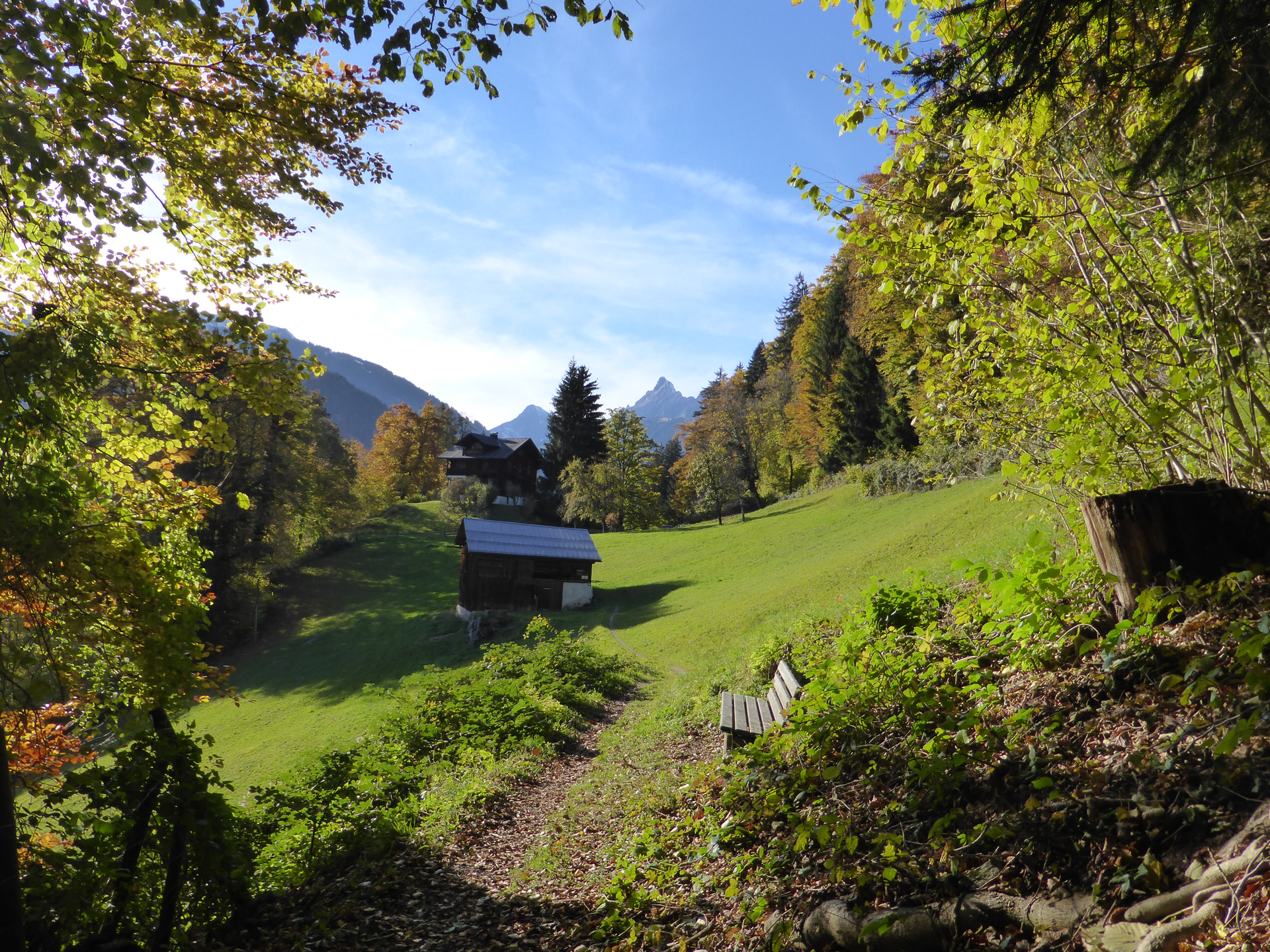
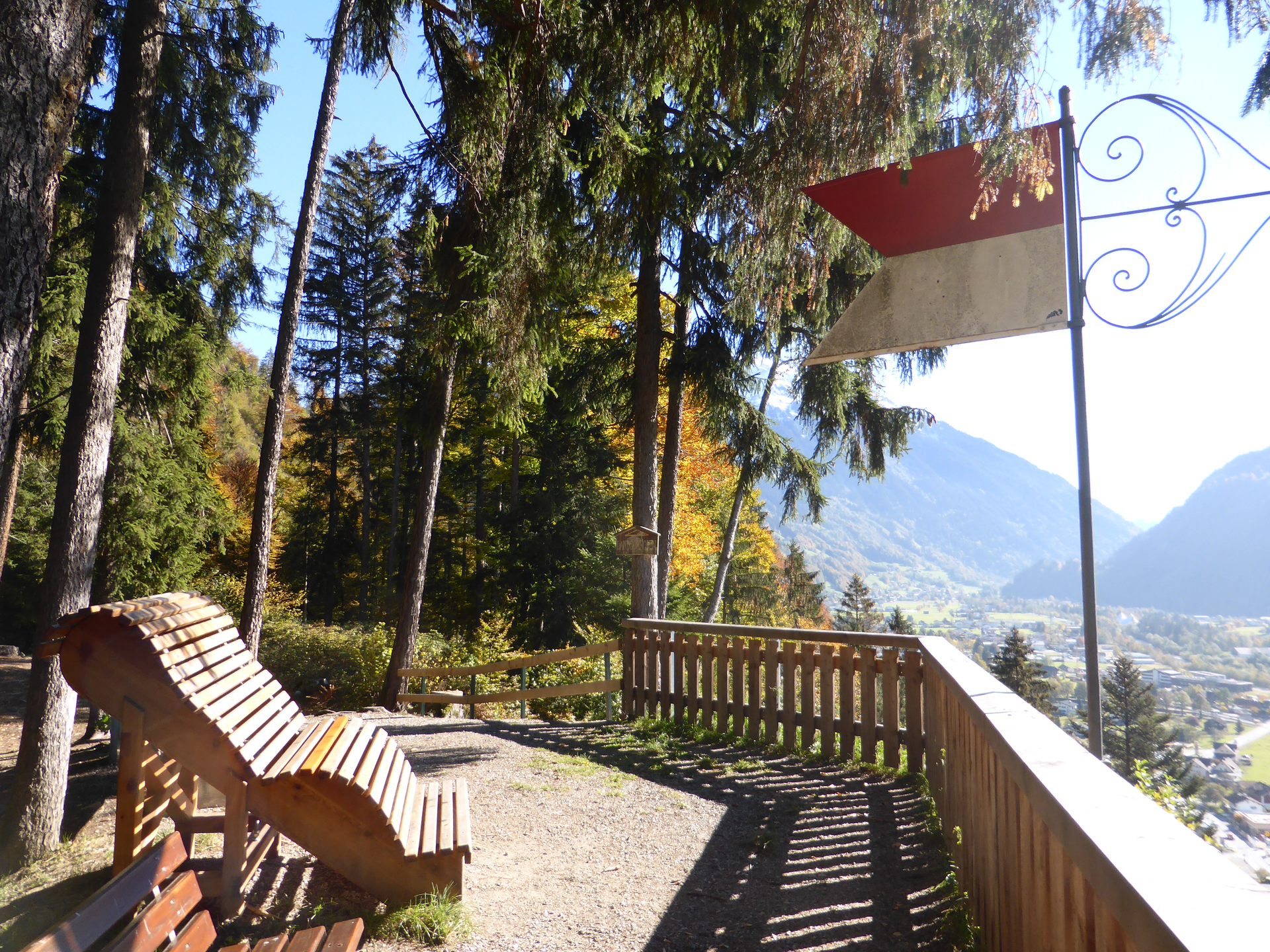
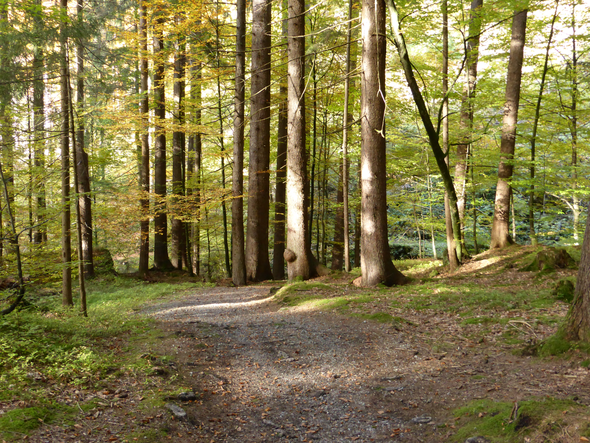
A short visit to the monastery is recommended before continuing your walk/hike. A few meters past Gauenstein Monastery you reach another signpost. Here you keep to the direction of Kaltenbrunnen or Landschrofen-Känzili (approximately 10 minutes is indicated). A detour to the Landschrofen-Känzili viewpoint is worthwhile. At the Landschrofen-Känzili viewpoint you can enjoy a view towards Schruns-Tschagguns and Vandans. In good visibility, the famous Three Towers in the Rätikon can also be seen. Benches are also available here for resting. After visiting the viewpoint, keep left and continue through the forest where a gentle descent begins.

After about 20 minutes you reach the L188 (main road). A few meters towards Gantschier church on the same side is JUFA Montafon. On the opposite side of the street is the Schapler bakery branch and the Liberty snack bar. You cross the street at the zebra crossing and follow the signpost to Kaltenbrunnen train station on the pavement. After crossing the railway tracks (Kaltenbrunnen station) you turn left and follow the asphalted Ill cycle path back to Schruns.

Safety instructions

EMERGENCY CALL:
140 Alpine emergencies throughout Austria
144 Alpine emergencies Vorarlberg
112 European emergency call (works with any mobile phone/network)
www.vorarlberg.travel/sicherheitstipps

Destination

Kirchplatz Schruns

Starting Point

Kirchplatz Schruns

Eigenschaften
Routentyp Hiking, Refreshment stops, Round trip, Family-friendly
Schwierigkeit Easy
Höhenprofil
Beste Jahreszeit
Jan
Feb
Mär
Apr
Mai
Jun
Jul
Aug
Sep
Okt
Nov
Dez