Maisäß route St​.​ Gallenkirch

Moderate
Hiking
04:32 h duration
9,9 km Länge
1656 m Höchster Punkt
880 m Tiefster Punkt
971 hm Aufstieg
953 hm Abstieg
Kondition
Schwierigkeit
Erlebnis
Landschaft

Tourbeschreibung

This Maisäß route offers you splendid views of the Montafon mountain landscape.
Description

The Maisäß route lets you leisurely hike the various Maisäß farms along idyllic meadow paths. For many Montafon locals, the Maisäß farms are magical places for pausing, remembering, and relaxing. They have shaped the entire landscape of the Montafon region for centuries.

Approach

Take the A14 to the Bludenz/Montafon exit and continue on Montafonerstraße L188 to St. Gallenkirch.

Public transport

Just leave your car standing

The regional buses operate throughout the Montafon. The main lines run every half hour from Schruns station.

Bus stop at the start of the route: St. Gallenkirch center / line 650

Bus stop at the end of the route: Gortipohl center / line 650

Timetable: www.vmobil.at

Arrival by train to Montafon

From Bludenz station, the Montafon railway runs hourly (sometimes every half hour). There are also direct connections from Lindau (D) or from Bregenz.

Timetable: www.oebb.at

Parking

Parking lot center St. Gallenkirch

Directions

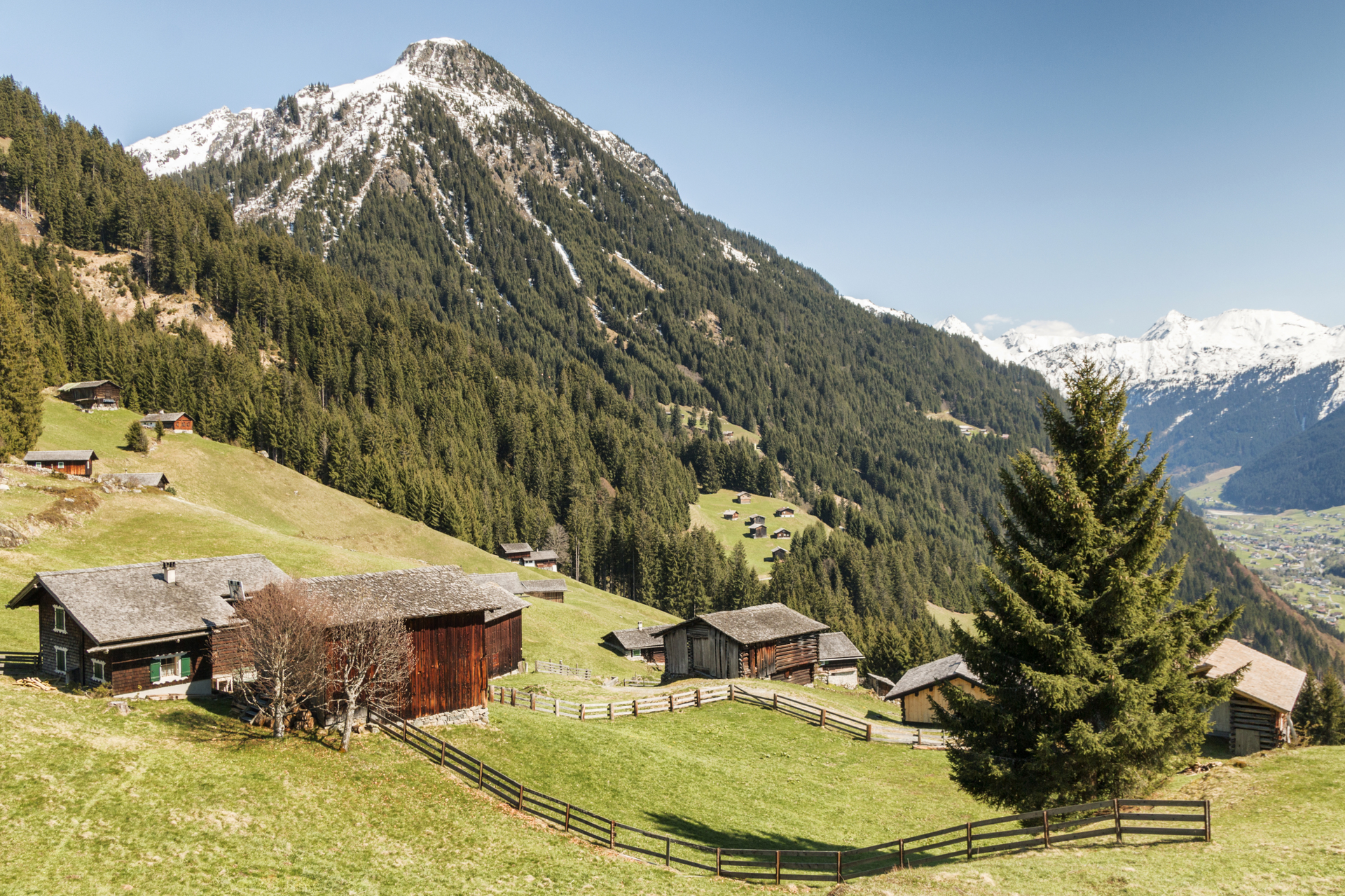
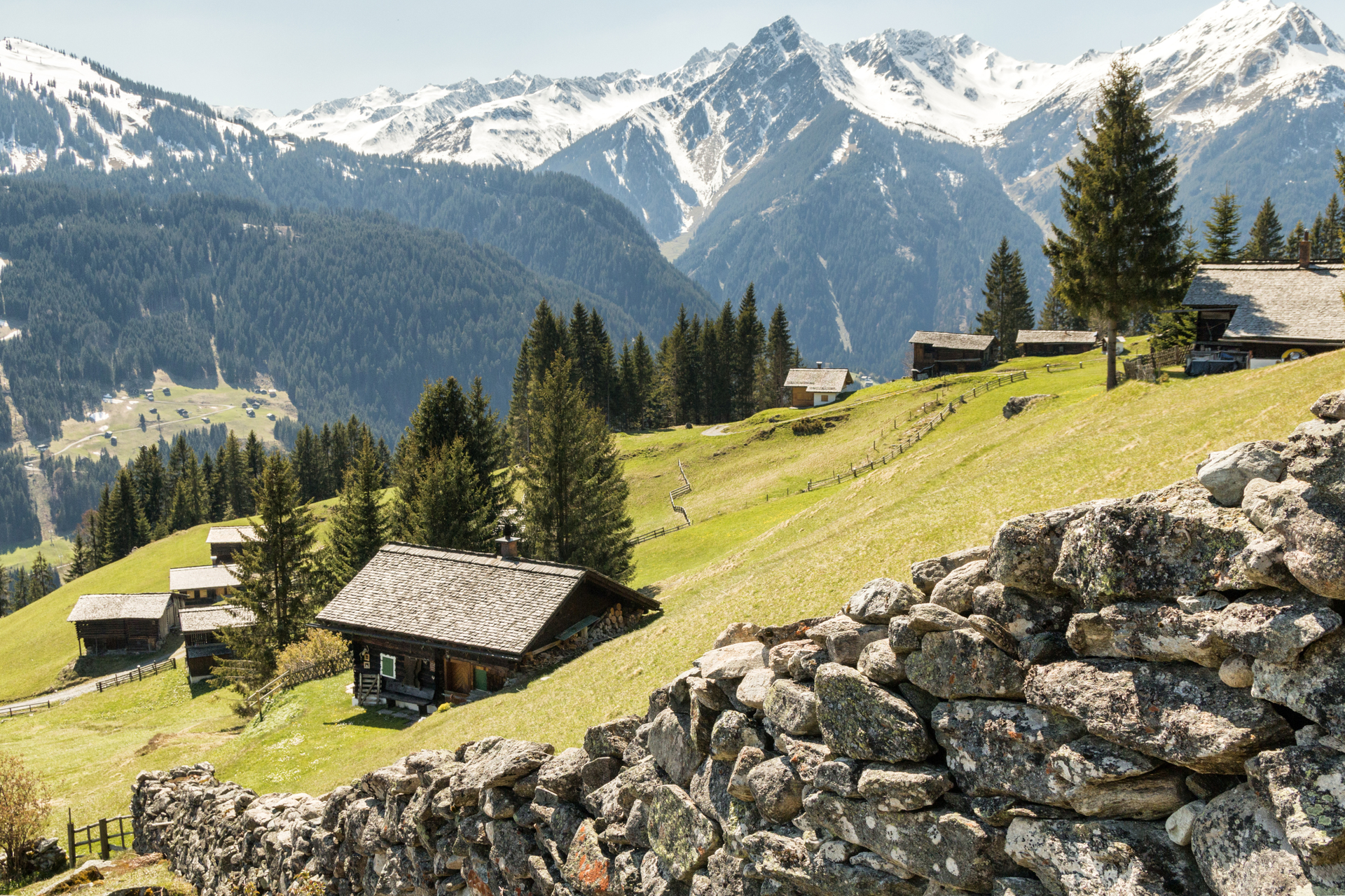
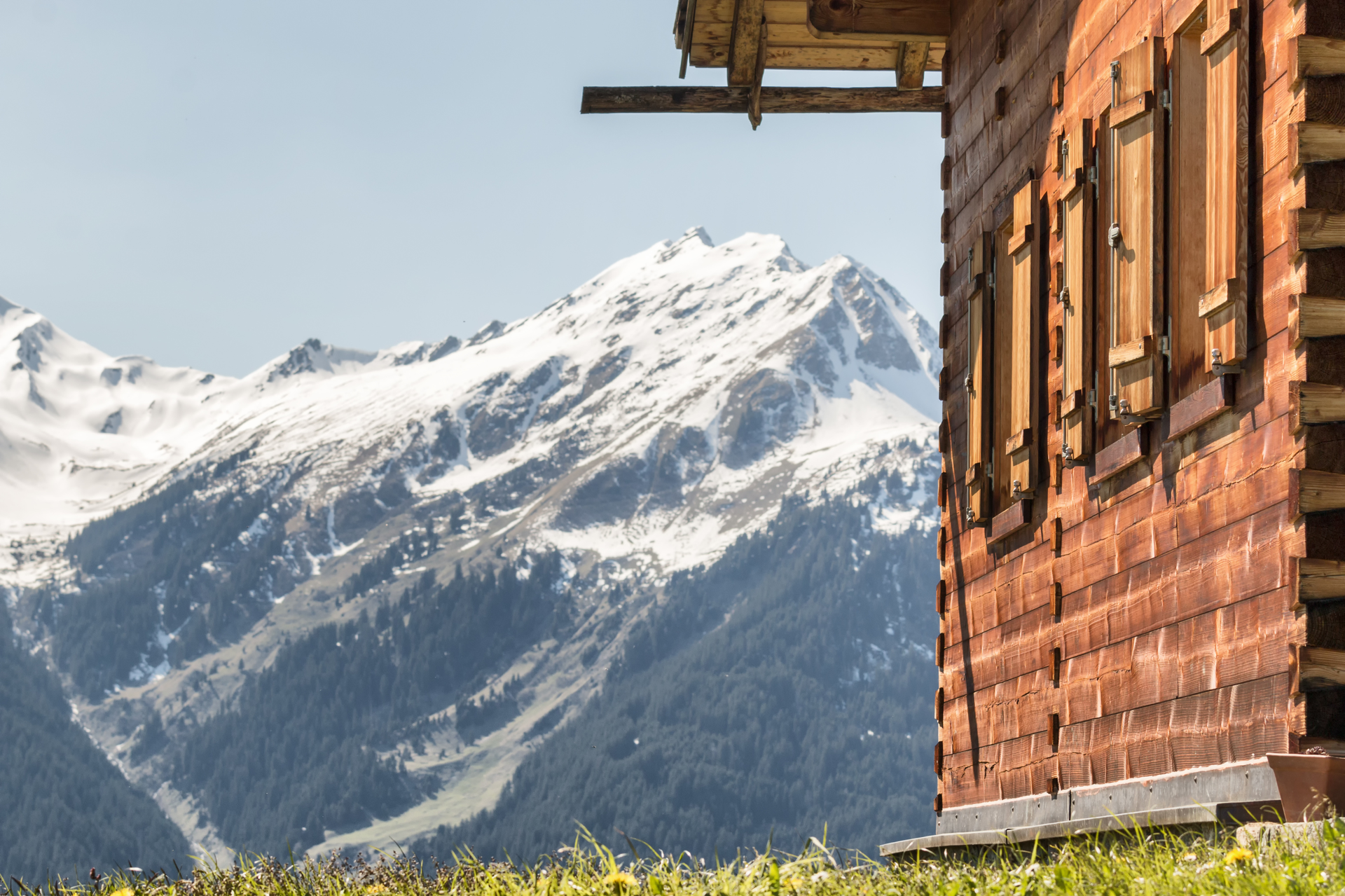
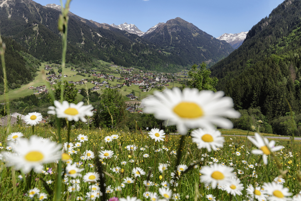
The route starts in St. Gallenkirch. You follow the signpost uphill towards Schoder. Initially, you still walk on the residential streets, which then gradually lead into a Schottwerweg. Upon reaching the Schoder area, follow the signpost to the Montiel Maisäß. Shortly before the Montiel Maisäß, we pass the Fleischatobel, and at the junction of the Schoderweg, you take the path again to the clean and weather-browned huts of the Montiel Maisäß. Here you have a great view of the Zamangspitze to the northwest. The wide path leads you to the uppermost buildings with a small chapel and views of the mountains around Hochmaderer and towards Gaschurn. What a Montafon idyll! The small sign 'Netza-Maisäß' directs you again to a path. You walk over a clearing, cross a few small streams at the extension of the Hüttnertobel, and, without getting much out of breath, reach the small hut village Netza-Maisäß with modest mountain meadows. From Netza-Maisäß, the path goes downhill. At the fork, keep to Monigg, so you can reach the Maisäß farms at Sasarscha. Once there, enjoy the views again before beginning the descent into the valley. Shortly before Gortipohl, we make a small detour to the Balbier waterfall, which here falls from an overhang and offers you a refreshing end to the route. From there, it is not far to the center of Gortipohl.

Safety instructions

EMERGENCY CALL: 144
European emergency number: 112 (works with any mobile/net)
www.vorarlberg.travel/sicherheitstipps

Equipment

Day hiking backpack (approx. 20 liters) with rain cover, sturdy and comfortable footwear, weather-appropriate and durable layered clothing, if necessary telescopic poles, sun and rain protection, provisions and drinking water, first aid kit, pocket knife, mobile phone, if necessary headlamp, maps

Tips

On hot summer days, the path past the Balbier waterfall is especially pleasant.

Destination

Gortipohl

Starting Point

St. Gallenkirch, center

Eigenschaften
Routentyp Hiking
Schwierigkeit Moderate
Höhenprofil
Beste Jahreszeit
Jan
Feb
Mär
Apr
Mai
Jun
Jul
Aug
Sep
Okt
Nov
Dez